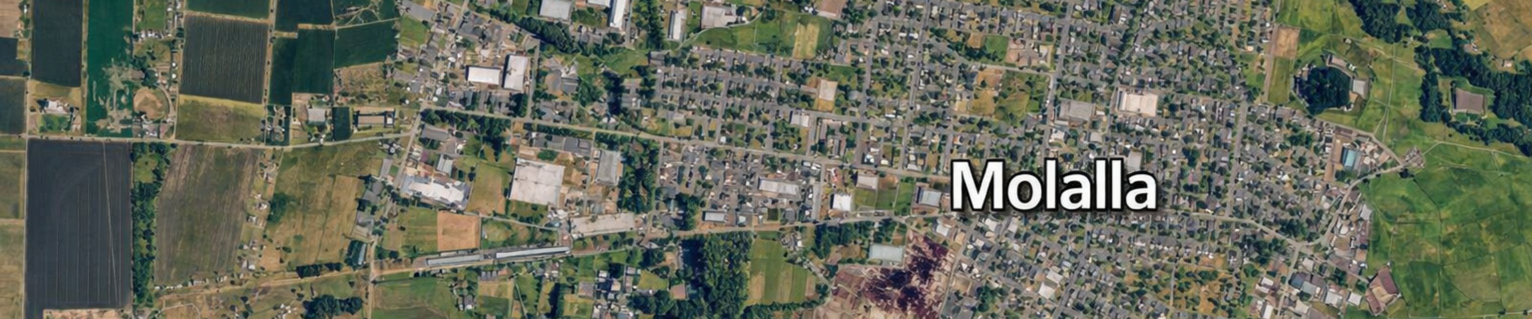
Molalla's Urban Growth Boundary (UGB)

Share Molalla's Urban Growth Boundary (UGB) on Facebook Share Molalla's Urban Growth Boundary (UGB) on X (formerly Twitter) Share Molalla's Urban Growth Boundary (UGB) on Linkedin Email Molalla's Urban Growth Boundary (UGB) link

***TAKE THE UGB SURVEY BY CLICKING ANYWHERE ON THIS BANNER. ANY AREA SPECIFIC INFO YOU CAN PROVIDE IS VALUED AND IF YOU HAVE PROPERTY SPECIFIC INFO THAT IS ALSO VERY USEFUL FOR US AT THIS TIME***


This project determines where the City's UGB will expand and by how much

Follow this page to receive information on project status and opportunities to provide public input. Tabs to the right will guide you to completed documents and upcoming meeting dates.


Step 1. Sequential UGB Process Approval

Adopted By Molalla City Council and Clackamas County Commission March 2023; DLCD Approval May 2023

The City of Molalla is the first city in Oregon to use this new process for UGB amendments. It requires cities to develop a workplan adopted by Molalla's City Council, County Board, and Department of Land Conservation and Development (DLCD). Further steps in Molalla's adopted workplan are outlined below.


Step 2. Housing Needs Analysis/Buildable Lands Inventory

Adopted By Molalla City Council July 2023; DLCD Approval December 2023

This first study looks at the 20-year growth projection and available residential buildable land currently inside the UGB to determine whether additional lands will be required to accommodate that projected growth. Once complete, this study is adopted into the City’s Comprehensive Plan.


Step 3. Housing Production Strategies

Adopted By Molalla City Council March 2025; DLCD Remand August 2025; Readoption Planned for February 2026

The housing production strategies document devises strategies with input from public bodies, advisory committees, and the public to address housing needs identified in the Housing Needs Analysis.


Step 4. Economic Opportunities Analysis/Buildable Lands Inventory

Adopted By Molalla City Council March 2025; DLCD Approval August 2025

Like Step 2 above, this study focuses on 20-year land needs and evaluates available land within the existing UGB but focuses on Industrial and Commercial employment lands to ensure the City has land to provide enough employment opportunities to support it’s population. This study also looks at current industry trends to provide target industries and project needed site types and size for projected employment land needs.


Step 5. Efficiency Measures

Adopted By Molalla City Council June 2025; DLCD Approval October 2025*

This portion of the process includes the implementation phase of the Housing Production Strategies work done to satisfy HB 2003 and evaluates land within the current UGB to determine if processes such as rezoning could cause them to be used more efficiently. Before the City can determine it’s final 20-year land need, some efficiency measures must be adopted to ensure the City is getting the most opportunity out of the lands currently inside the UGB. This may reduce the 20-year land need.

*DLCD approval


Step 6. Goal 14 Land Studies

Adopted By Molalla City Council June 2025; Study amendment grant to be completed with UGB analysis and adopted by Molalla City Council in February 2026. This amendment will consider a cost analysis of northern and western expansion vs. a southern expansion into the exception lands.

This step requires identification of a “study area” that is typically a consistent area outside the city boundaries in every direction (e.g. one mile). Once the study area is identified, the lands in that area are assessed under state guidelines to determine what the most appropriate areas are to include in a potential UGB amendment.

The state guidelines for assessment include things like: soil qualities, parcel sizes, utility serviceability and more. You can find a full recording of the April 22nd Public Meeting here: https://www.youtube.com/watch?v=pN02OhD97Ps

NOTE: Per the December 25th announcement, the City is currently under contract with DLCD to do additional Goal 14 work to identify potential costs for development in exception land subareas vs. lands to the north.


Step 7. UGB Amendment

Underway - anticipated adoption by City Council in September, 2026

Upon adoption and/or approval (as applicable) of the items in Steps 1-6 above, the City will file with Clackamas County’s Board of Commissioners to modify the City’s UGB as determined by the results of this process.

***TAKE THE UGB SURVEY BY CLICKING ANYWHERE ON THIS BANNER. ANY AREA SPECIFIC INFO YOU CAN PROVIDE IS VALUED AND IF YOU HAVE PROPERTY SPECIFIC INFO THAT IS ALSO VERY USEFUL FOR US AT THIS TIME***


This project determines where the City's UGB will expand and by how much

Follow this page to receive information on project status and opportunities to provide public input. Tabs to the right will guide you to completed documents and upcoming meeting dates.


Step 1. Sequential UGB Process Approval

Adopted By Molalla City Council and Clackamas County Commission March 2023; DLCD Approval May 2023

The City of Molalla is the first city in Oregon to use this new process for UGB amendments. It requires cities to develop a workplan adopted by Molalla's City Council, County Board, and Department of Land Conservation and Development (DLCD). Further steps in Molalla's adopted workplan are outlined below.


Step 2. Housing Needs Analysis/Buildable Lands Inventory

Adopted By Molalla City Council July 2023; DLCD Approval December 2023

This first study looks at the 20-year growth projection and available residential buildable land currently inside the UGB to determine whether additional lands will be required to accommodate that projected growth. Once complete, this study is adopted into the City’s Comprehensive Plan.


Step 3. Housing Production Strategies

Adopted By Molalla City Council March 2025; DLCD Remand August 2025; Readoption Planned for February 2026

The housing production strategies document devises strategies with input from public bodies, advisory committees, and the public to address housing needs identified in the Housing Needs Analysis.


Step 4. Economic Opportunities Analysis/Buildable Lands Inventory

Adopted By Molalla City Council March 2025; DLCD Approval August 2025

Like Step 2 above, this study focuses on 20-year land needs and evaluates available land within the existing UGB but focuses on Industrial and Commercial employment lands to ensure the City has land to provide enough employment opportunities to support it’s population. This study also looks at current industry trends to provide target industries and project needed site types and size for projected employment land needs.


Step 5. Efficiency Measures

Adopted By Molalla City Council June 2025; DLCD Approval October 2025*

This portion of the process includes the implementation phase of the Housing Production Strategies work done to satisfy HB 2003 and evaluates land within the current UGB to determine if processes such as rezoning could cause them to be used more efficiently. Before the City can determine it’s final 20-year land need, some efficiency measures must be adopted to ensure the City is getting the most opportunity out of the lands currently inside the UGB. This may reduce the 20-year land need.

*DLCD approval


Step 6. Goal 14 Land Studies

Adopted By Molalla City Council June 2025; Study amendment grant to be completed with UGB analysis and adopted by Molalla City Council in February 2026. This amendment will consider a cost analysis of northern and western expansion vs. a southern expansion into the exception lands.

This step requires identification of a “study area” that is typically a consistent area outside the city boundaries in every direction (e.g. one mile). Once the study area is identified, the lands in that area are assessed under state guidelines to determine what the most appropriate areas are to include in a potential UGB amendment.

The state guidelines for assessment include things like: soil qualities, parcel sizes, utility serviceability and more. You can find a full recording of the April 22nd Public Meeting here: https://www.youtube.com/watch?v=pN02OhD97Ps

NOTE: Per the December 25th announcement, the City is currently under contract with DLCD to do additional Goal 14 work to identify potential costs for development in exception land subareas vs. lands to the north.


Step 7. UGB Amendment

Underway - anticipated adoption by City Council in September, 2026

Upon adoption and/or approval (as applicable) of the items in Steps 1-6 above, the City will file with Clackamas County’s Board of Commissioners to modify the City’s UGB as determined by the results of this process.

Ask A Question

Staff responds to questions 3 times per week.  You will receive an email when your question has been answered.  

Email
loader image
Didn't receive confirmation?
Seems like you are already registered, please provide the password. Forgot your password? Create a new one now.
  • Share How are the approximately 177 acres in the proposed UGB amendment divided among residential, industrial, commercial, public facilities, roads, parks, and other uses? For the residential portion, how many acres are expected to be buildable and how many housing units are expected? on Facebook Share How are the approximately 177 acres in the proposed UGB amendment divided among residential, industrial, commercial, public facilities, roads, parks, and other uses? For the residential portion, how many acres are expected to be buildable and how many housing units are expected? on X (formerly Twitter) Share How are the approximately 177 acres in the proposed UGB amendment divided among residential, industrial, commercial, public facilities, roads, parks, and other uses? For the residential portion, how many acres are expected to be buildable and how many housing units are expected? on Linkedin Email How are the approximately 177 acres in the proposed UGB amendment divided among residential, industrial, commercial, public facilities, roads, parks, and other uses? For the residential portion, how many acres are expected to be buildable and how many housing units are expected? link

    How are the approximately 177 acres in the proposed UGB amendment divided among residential, industrial, commercial, public facilities, roads, parks, and other uses? For the residential portion, how many acres are expected to be buildable and how many housing units are expected?

    Jennifer Satter asked 6 days ago

    Jennifer - thanks for the follow up. There was a misstatement in response to your initial question that I will clear up here: 

    The 177 acres are strictly the portion of the expansion that is allotted to residential based on the considerations outlined in your previous question. A portion of the land allotted to residential (25%) accounts for public infrastructure including open space and right-of-way planning.

    Additionally:

    6.8 Acres of the proposed expansion are proposed as Commercial

    76.3 Acres of the proposed expansion are proposed as Industrial.

    84.8 acres of land is proposed as Public/Semi Public 37.4 acres of which is Ivor Davies Park, which is currently owned and operated as a park by the City of Molalla. The remainder of this land is anticipated as wetland based on state wetland and inventories. If these estimates are short there is a chance some of this land could be site suitable as industrial. There are also planned trails facilities along Bear Creek through the proposed Public/Semi Public lands adjacent to Ivor Davies Park and the lands may be used for wetlands mitigation.  

    The main consideration for buildability will be presence of wetlands. The City has applied for grant funding for a forthcoming study for a Local Wetlands Inventory in the expansion territories. While we can't yet provide a precise figure for buildable, the City doesn't expect that a substantial portion of the proposed expansion for residential, commercial, and industrial will be wetlands based on state wetland inventories and local knowledge of the area. Housing calculations are anticipated at 925 units less any portions that may be subtracted due to wetland designations.  

    Apologies for the confusion from the initial response. 

  • Share what is under construction across the street from the moose lodge? vicinity of Eckard / 5th. on Facebook Share what is under construction across the street from the moose lodge? vicinity of Eckard / 5th. on X (formerly Twitter) Share what is under construction across the street from the moose lodge? vicinity of Eckard / 5th. on Linkedin Email what is under construction across the street from the moose lodge? vicinity of Eckard / 5th. link

    what is under construction across the street from the moose lodge? vicinity of Eckard / 5th.

    M_Holland asked 6 days ago

    Good afternoon, 

    There is not currently a proposed development project on that site and the City has not received an application for development for that site. There is a remediation project underway on that site and that is the extent of current authorized activity. Our understanding is that the following notice is posted on the boundary of that site: 

    ENVIRONMENTAL CLEANUP & WETLAND RESTORATION PROJECT 

    As part of a DEQ cleanup and restoration project, some soils on this industrial site will be removed or capped. In addition, 17 acres of enhanced wetlands are being created to replace and improve valuable wetland habitat. These wetlands will: 

    • Filter stormwater and improve water quality
    • Provide habitat for birds and other wildlife
    • Help reduce flooding by storing and slowly releasing water
    • Support healthy native plants and ecosystems


    Please help us protect this restoration area. 

    Please stay off the property to avoid disturbing newly planted vegetation and wildlife habitat.  Trespassing in wetland areas is strictly prohibited. If you need additional information please call: 971-245-2228

    Avison Lumber Co.

  • Share The 2026 Housing Production Strategy appears to show 1,003 units of adjusted buildable-land and rezoning capacity, plus 287 pipeline units completed since the Housing Needs Analysis. Subtracting both figures from the stated need of 1,996 units appears to leave 706 units, but the Goal 14 analysis and Public Facilities Review use a remaining need of 929 units. Can the City please provide the full calculation showing how it arrived at 929 units, including whether the 1,003-unit capacity figure already includes the 287 completed units, how Ordinance 2025-07 and other efficiency measures were credited, and whether any figures overlap? on Facebook Share The 2026 Housing Production Strategy appears to show 1,003 units of adjusted buildable-land and rezoning capacity, plus 287 pipeline units completed since the Housing Needs Analysis. Subtracting both figures from the stated need of 1,996 units appears to leave 706 units, but the Goal 14 analysis and Public Facilities Review use a remaining need of 929 units. Can the City please provide the full calculation showing how it arrived at 929 units, including whether the 1,003-unit capacity figure already includes the 287 completed units, how Ordinance 2025-07 and other efficiency measures were credited, and whether any figures overlap? on X (formerly Twitter) Share The 2026 Housing Production Strategy appears to show 1,003 units of adjusted buildable-land and rezoning capacity, plus 287 pipeline units completed since the Housing Needs Analysis. Subtracting both figures from the stated need of 1,996 units appears to leave 706 units, but the Goal 14 analysis and Public Facilities Review use a remaining need of 929 units. Can the City please provide the full calculation showing how it arrived at 929 units, including whether the 1,003-unit capacity figure already includes the 287 completed units, how Ordinance 2025-07 and other efficiency measures were credited, and whether any figures overlap? on Linkedin Email The 2026 Housing Production Strategy appears to show 1,003 units of adjusted buildable-land and rezoning capacity, plus 287 pipeline units completed since the Housing Needs Analysis. Subtracting both figures from the stated need of 1,996 units appears to leave 706 units, but the Goal 14 analysis and Public Facilities Review use a remaining need of 929 units. Can the City please provide the full calculation showing how it arrived at 929 units, including whether the 1,003-unit capacity figure already includes the 287 completed units, how Ordinance 2025-07 and other efficiency measures were credited, and whether any figures overlap? link

    The 2026 Housing Production Strategy appears to show 1,003 units of adjusted buildable-land and rezoning capacity, plus 287 pipeline units completed since the Housing Needs Analysis. Subtracting both figures from the stated need of 1,996 units appears to leave 706 units, but the Goal 14 analysis and Public Facilities Review use a remaining need of 929 units. Can the City please provide the full calculation showing how it arrived at 929 units, including whether the 1,003-unit capacity figure already includes the 287 completed units, how Ordinance 2025-07 and other efficiency measures were credited, and whether any figures overlap?

    Jennifer Satter asked 7 days ago

    In estimating capacity, 27.88 acres of R3 land can accommodate 558 units based on R3 having an average density of 20 units per acre. The 287 pipeline units are also R3. Since the HNA calls for a need of 399 R3 units, this capacity creates a surplus of R3 (446 units) and we can assume that while those units would be allowed under zoning, the market wouldn't actually build them at maximum capacity and instead would result in that land at a density closer to R2 (10 units per acre). Thus, the need was adjusted to account for some of that 558 being allocated to R2 and that the rezoning met the full need for R3 and 223 of the R2 land as well. Leaving 34 R2 and 894 R1, which gets us to the 929. The switch in density to keep the totals in line with the housing mix in the HNA is why the numbers shift.  

    Important caveat to this is that the updated Goal 14 Analysis will be switching from the average density approach (R1 as 5 units per acre, R2 as 10 units per acre, and R3 as 20 units per acre) that was used in 2025 to comply with the Safe Harbor rules required by the state to be an average of 7 dwelling units per acre across all residential land, which was mentioned in the HNA and we have learned was made binding when it was adopted. While the 7-unit/acre density assumption brings the remaining units up from 929 to 1,114 units, it brings the total number of acres down from 223 to 198. The goal of the expansion is then to accommodate as much of that need as is practical without going over. 

    The suggested amendment is for approximately 177 acres of land being added to the UGB. 

  • Share Question for homeowners within the proposed ugb that have septic and wells… will these properties eventually have to hook up to city water/sewer services if growth extends out to and around them? on Facebook Share Question for homeowners within the proposed ugb that have septic and wells… will these properties eventually have to hook up to city water/sewer services if growth extends out to and around them? on X (formerly Twitter) Share Question for homeowners within the proposed ugb that have septic and wells… will these properties eventually have to hook up to city water/sewer services if growth extends out to and around them? on Linkedin Email Question for homeowners within the proposed ugb that have septic and wells… will these properties eventually have to hook up to city water/sewer services if growth extends out to and around them? link

    Question for homeowners within the proposed ugb that have septic and wells… will these properties eventually have to hook up to city water/sewer services if growth extends out to and around them?

    June wood-walch asked 3 months ago

    Thank you for your question!  

    City water and sewer service is required when: 

    1. The property is inside the City limits (not the Urban Growth Boundary); and   

    2. The service is available within 300 feet of the property.

    So, to answer your question directly the determination on connection to City services is not based on whether growth extends out and around a property.  It's determined by the property coming into the City limits and the distance to a given service connection from the property lines.  

    Note that if your property is included in a UGB expansion it does not come into the City limits, it comes into the Urban Growth Boundary.

    Sincerely, 


    The Molalla Current Project Team    

  • Share Do you happen to have a link to your zoning codes? I’m specifically looking for the Low‑ and Medium‑Density Residential and Public/Semi‑Public designations. on Facebook Share Do you happen to have a link to your zoning codes? I’m specifically looking for the Low‑ and Medium‑Density Residential and Public/Semi‑Public designations. on X (formerly Twitter) Share Do you happen to have a link to your zoning codes? I’m specifically looking for the Low‑ and Medium‑Density Residential and Public/Semi‑Public designations. on Linkedin Email Do you happen to have a link to your zoning codes? I’m specifically looking for the Low‑ and Medium‑Density Residential and Public/Semi‑Public designations. link

    Do you happen to have a link to your zoning codes? I’m specifically looking for the Low‑ and Medium‑Density Residential and Public/Semi‑Public designations.

    Seanna asked 4 months ago

    I'm not quite sure what you're looking for but If you're looking for a zoning map, you can find it here. If you're looking for what can be built in the zones you can expand the allowed uses table from this section of the code. If you're looking for lot standards for each zone, expand the tables from this section of the code

    If you're looking for something else, please contact the Molalla Planning Department at communityplanner@cityofmolalla.com

  • Share Will we be effected by the UBG at 32270 S. Ona Way on Facebook Share Will we be effected by the UBG at 32270 S. Ona Way on X (formerly Twitter) Share Will we be effected by the UBG at 32270 S. Ona Way on Linkedin Email Will we be effected by the UBG at 32270 S. Ona Way link

    Will we be effected by the UBG at 32270 S. Ona Way

    Timtim asked 8 months ago

    Hi, 

    Sorry for the late response. We have not yet determined which lands we will be expanding into but have done some background studies that prioritize potential expansion lands. Per state laws on urban growth boundary expansion, your property is located in one of the 7 subareas that is highest priority for expansion due its current zoning. With that said, I think it's fairly unlikely that your property would be selected due to the relatively small amount of residential land that we're looking to annex (roughly 200 acres) and your fairly distant proximity to the city. There are a lot of other areas of greater interest but it's not impossible. 

    The City will be completing additional Goal 14 analysis this spring and summer and then re-engaging the public in another summit in late summer so keep your eye on the mail and this site for updates in that regard. Or feel free to reach out to communityplanner@cityofmolalla.com for updates or if you want to send info about your property specifically and why you may or may not want it included.  

  • Share We got a notice in the mail that our property might be removed from M2 to C2. When can we expect to be notified of that decision? And if it is going to change when will that take place? on Facebook Share We got a notice in the mail that our property might be removed from M2 to C2. When can we expect to be notified of that decision? And if it is going to change when will that take place? on X (formerly Twitter) Share We got a notice in the mail that our property might be removed from M2 to C2. When can we expect to be notified of that decision? And if it is going to change when will that take place? on Linkedin Email We got a notice in the mail that our property might be removed from M2 to C2. When can we expect to be notified of that decision? And if it is going to change when will that take place? link

    We got a notice in the mail that our property might be removed from M2 to C2. When can we expect to be notified of that decision? And if it is going to change when will that take place?

    EliseK asked over 1 year ago

    Good morning,

    City Council recently passed a zoning ordinance and the details can be found in the documents tab to the right on this page under "Step 5. Efficiency Measures." For further details, please contact the Community Development Department at communityplanner@cityofmolalla.com and provide property information for our reference as some of the details from here will be property specific.

  • Share I am hearing rumors that there is a proposal to incorporate areas south of town ( specifically the area bordered by Mathias, Sawtell, Molalla Ave, and Dressler) into the UBG in the next four years. Is that true? If so, is there a map? on Facebook Share I am hearing rumors that there is a proposal to incorporate areas south of town ( specifically the area bordered by Mathias, Sawtell, Molalla Ave, and Dressler) into the UBG in the next four years. Is that true? If so, is there a map? on X (formerly Twitter) Share I am hearing rumors that there is a proposal to incorporate areas south of town ( specifically the area bordered by Mathias, Sawtell, Molalla Ave, and Dressler) into the UBG in the next four years. Is that true? If so, is there a map? on Linkedin Email I am hearing rumors that there is a proposal to incorporate areas south of town ( specifically the area bordered by Mathias, Sawtell, Molalla Ave, and Dressler) into the UBG in the next four years. Is that true? If so, is there a map? link

    I am hearing rumors that there is a proposal to incorporate areas south of town ( specifically the area bordered by Mathias, Sawtell, Molalla Ave, and Dressler) into the UBG in the next four years. Is that true? If so, is there a map?

    DCulmsee asked almost 2 years ago

    Thank you for your question!  I'm going to start with the last one and work backward, I think the response will make more sense that way. 

    1. Is there a map?  No map has been developed, proposed, or approved for UGB modification. 

    2. Is that true (that there is a proposal to incorporate areas south of town)?  No, the UGB expansion process will ultimately lead to a proposal to add land of some sort, but we are quite a way off from that point in the project.  If you go to the Molalla Current page for the UGB, it runs you through the steps of the process.  One of those steps that has not been reached yet is to conduct land studies.  These studies typically occur on all of the land within 1-mile of the current UGB in all directions.  One of the outcomes of that land study is identification of the land that would be proposed to come into the UGB to meet the 20-year housing and employment demand.  The land is assessed based on several factors to determine what the most appropriate land to expand the UGB would be under state law.  At that time, a proposed expansion area will be identified.  

    Our best guess as to when that proposed expansion area will be identified is likely late 2025 or early 2026.  

    Sincerely, 

    The Molalla Current Project Team

  • Share Hi, I don't see noted above a study for needed Public and Semi-Public lands (Parks and Schools). I don't recall that need being specifically addressed in the housing needs study other than a statement of 25% of land for housing. But typically land for residential development is considered 75% useable as 25% is used for Streets, utilities etc. (not parks and schools). The Previous studies From Winterbrook within the last 5 years found a need for about 120 Acres for Public and Semi-Public lands. Have I misread the housing study, and that need is addressed above the 25% for streets or is there a study needed that is not addressed above. on Facebook Share Hi, I don't see noted above a study for needed Public and Semi-Public lands (Parks and Schools). I don't recall that need being specifically addressed in the housing needs study other than a statement of 25% of land for housing. But typically land for residential development is considered 75% useable as 25% is used for Streets, utilities etc. (not parks and schools). The Previous studies From Winterbrook within the last 5 years found a need for about 120 Acres for Public and Semi-Public lands. Have I misread the housing study, and that need is addressed above the 25% for streets or is there a study needed that is not addressed above. on X (formerly Twitter) Share Hi, I don't see noted above a study for needed Public and Semi-Public lands (Parks and Schools). I don't recall that need being specifically addressed in the housing needs study other than a statement of 25% of land for housing. But typically land for residential development is considered 75% useable as 25% is used for Streets, utilities etc. (not parks and schools). The Previous studies From Winterbrook within the last 5 years found a need for about 120 Acres for Public and Semi-Public lands. Have I misread the housing study, and that need is addressed above the 25% for streets or is there a study needed that is not addressed above. on Linkedin Email Hi, I don't see noted above a study for needed Public and Semi-Public lands (Parks and Schools). I don't recall that need being specifically addressed in the housing needs study other than a statement of 25% of land for housing. But typically land for residential development is considered 75% useable as 25% is used for Streets, utilities etc. (not parks and schools). The Previous studies From Winterbrook within the last 5 years found a need for about 120 Acres for Public and Semi-Public lands. Have I misread the housing study, and that need is addressed above the 25% for streets or is there a study needed that is not addressed above. link

    Hi, I don't see noted above a study for needed Public and Semi-Public lands (Parks and Schools). I don't recall that need being specifically addressed in the housing needs study other than a statement of 25% of land for housing. But typically land for residential development is considered 75% useable as 25% is used for Streets, utilities etc. (not parks and schools). The Previous studies From Winterbrook within the last 5 years found a need for about 120 Acres for Public and Semi-Public lands. Have I misread the housing study, and that need is addressed above the 25% for streets or is there a study needed that is not addressed above.

    MikeSimmons asked almost 3 years ago

    Hi Mike - the plan is roughly to fold public and semi-public land needs into the overall expansion study rather than into the individual studies. The City has also begun work on a new parks master plan and, while can't plan for the lands that we'll ultimately expand into, we've conveyed to our consultants that guidelines and implementation strategies for UGB expansion need to be a part of the document. Notably, there's a 20% land donation or fee in lieu of that's a part of our comprehensive plan that is not codified in the municipal code for subdivision expansion (though it has been for master planning) and we're also looking to rectify that. We've discussed the potential to amend our workplan to include the updated parks master plan with DLCD, which will allow us to take the policy suggestions from that document and incorporate them into our UGB expansion. DLCD has conveyed that they are amenable to that. Last, we intend to include the school district on our UGB TAC team and otherwise heavily consider their land need input.  

    The answer to this question is going to continue to evolve as we move forward with the TAC and our new consultant and we encourage you to continue to be a part of that conversation, as you have. 

  • Share Hello, When will the schedule of future planned studies be posted as part of the sequential UGB plan? In particular the next study to be done, description and planned start date. on Facebook Share Hello, When will the schedule of future planned studies be posted as part of the sequential UGB plan? In particular the next study to be done, description and planned start date. on X (formerly Twitter) Share Hello, When will the schedule of future planned studies be posted as part of the sequential UGB plan? In particular the next study to be done, description and planned start date. on Linkedin Email Hello, When will the schedule of future planned studies be posted as part of the sequential UGB plan? In particular the next study to be done, description and planned start date. link

    Hello, When will the schedule of future planned studies be posted as part of the sequential UGB plan? In particular the next study to be done, description and planned start date.

    MikeSimmons asked almost 3 years ago

    Thank you for your question, and our apologies for the delay in responding... somehow this question got missed.  We'll be updating our processes to ensure that does not occur in the future. 

    Staff cannot say with absolute certainty when each study will commence.  We do have a workplan that we will post on this Project page now, but things like budget, manpower, grant opportunities, grant application outcomes, and other variables tend to turn these sorts of long-term workplans into more of a flexible guide than an etched in stone calendar.  

    Please take a look at the workplan and stay tuned in to this project page and the newsletter for more!


    Best Regards, 

    The Molalla Current Project Team

Page last updated: 21 Jul 2026, 02:03 PM